Maryland's changing climate complicates planning for natural hazards and disaster response, which
have traditionally been tied to predictable cycles of natural events, based on historic trends.
Predictions for changes in the climate include: rising sea levels; longer periods of drought; more
frequent, intense storms; and the migration/loss of flora and fauna — all of which can
detrimentally impact historic places. These climatological changes will exaggerate the effects of
natural hazards. For example, sea level rise exacerbates tidal flooding, drought and intense rainfall
exacerbates erosion along riverbanks and coastal waterways, and a warmer, higher Chesapeake Bay will
allow hurricanes to push storm surge further inland. Migrating pests could pose new threats to historic
wood buildings, while migrating flora and fauna can replace native plantings and alter cultural landscapes.
Understanding the effects — and cumulative effects — of climate change is an ongoing process.
Most of the research in Maryland to date has focused on sea level rise. With funding from
the Certified Local Governments program, the Maryland Historical Trust partnered with
the City of Annapolis on its Weather It Together project to help build resilience to
sea-level rise. Informed by this and other local planning efforts, MHT added a section
on adaptation to the traditional emergency management cycle in Chapter 2 of its
Flood
Mitigation Guide: Maryland's Historic Buildings. Additional guidance and
updates will be developed as we learn more about climate impacts and options for historic properties
and cultural sites.
Sea-Level Rise and Historic Properties
Recent estimates for sea level rise
in Maryland encourage planning for a rise of approximately two feet over 50 years,
and as much as 3.7 feet by the year 2100. Of more immediate concern is that the intensity of coastal storms and the
height of coastal flood waters, such as those generated by Hurricane Sandy, may increase as a result of the changing
climate, creating additional risk. With vulnerability to rising tides and storm surges varying along the coast,
planning for sea-level rise must take place on a local level.
As the Chesapeake Bay and rivers and streams within the watershed were the primary historic and prehistoric trade
and transit routes in Maryland, the coastal areas of the Chesapeake contain a high concentration of vulnerable
historic architecture and archaeological sites. The Lower Eastern Shore, including the internationally significant
historic places associated with Harriet Tubman, is particularly threatened.
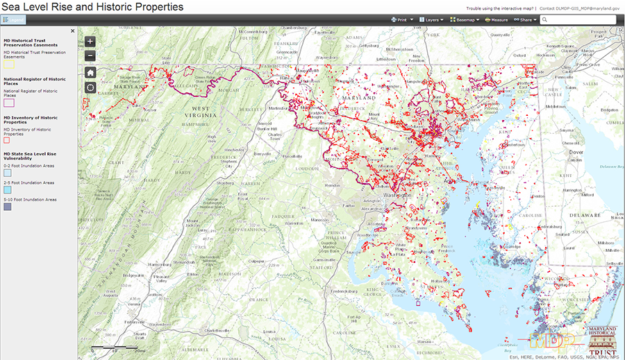 Click on image to view interactive map.
