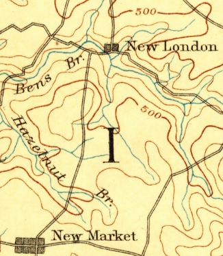
 New Market, Frederick County, MD (1893 Frederick USGS 1:125,000 topo quad map)
The Maryland Geographic Names Authority is the recognized state representative for Maryland who is responsible for coordinating place-naming
activity between local, state and federal agencies. The Authority promotes the standardization of names of geographic features mandated by
the United States Board on Geographic Names (BGN). The responsibility of the Authority is to review and make recommendations on behalf of the
State of Maryland for geographic name proposals submitted to the U.S. Board on Geographic Names, which has final approval authority.
Submit a Name Proposal
Submit a geographic name proposal to the BGN. Fill out a proposal form on the BGN website:
https://geonames.usgs.gov/domestic/index.html
Maryland Geographic Names Proposal Process
- Fill out and submit name proposal to the BGN
- BGN staff will ask questions and clarify information to make sure the proposal is complete
- Local representatives and land owners will be contacted about their opinion of the proposal
- Federal representatives will be contacted about their opinion of the proposal (if applicable)
- Maryland Geographic Names Authority will be contacted about their opinion of the proposal
- Maryland Geographic Names Authority will meet with the MSGIC executive committee to discuss the proposal and ask for
input from state representatives
- Maryland Geographic Names Authority will decide based on all the information what recommendation is given to the BGN
- BGN will review proposal and vote on name
- If the name is approved, the name is entered in the GNIS for use by Federal, State and Local agencies
Geographic Names Information System (GNIS)
Visit Site
The Geographic Names Information System (GNIS) is the Federal and national standard for geographic nomenclature. The U.S. Geological Survey
developed the GNIS in support of the U.S. Board on Geographic Names as the official repository of domestic geographic names data, the official
vehicle for geographic names use by all departments of the Federal Government, and the source for applying geographic names to Federal
electronic and printed products.
The GNIS contains information about physical and cultural geographic features of all types in the United States, associated areas, and Antarctica,
current and historical, but not including roads and highways. The database holds the Federally recognized name of each feature and defines
the feature location by state, county, USGS topographic map, and geographic coordinates. Other attributes include names or spellings other
than the official name, feature designations, feature classification, historical and descriptive information, and for some
categories the geometric boundaries.
United States Board on Geographic Names (BGN)
Visit Site
The U.S. Board on Geographic Names is a Federal body created in 1890 and established in its present form by Public Law in 1947 to maintain uniform
geographic name usage throughout the Federal Government. The Board comprises representatives of Federal agencies concerned with geographic
information, population, ecology, and management of public lands. Sharing its responsibilities with the Secretary of the Interior, the
Board promulgates official geographic feature names with locative attributes as well as principles, policies, and procedures governing the
use of domestic names, foreign names, Antarctic names, and undersea feature names.
» Principles, Policies and
Procedures – Domestic Geographic Names
Council of Geographic Names Authorities in the United States (CoGNA)
Visit Site
The Council of Geographic Names Authorities (COGNA) is an association of state and federal government agencies representing the official and
recognized geographic names authorities in the United States who work to promote national standardization of the names of geographic features for
official use throughout the country.
Maryland State Geographic Committee (MSGIC)
Visit Site
The Maryland State Geographic Information Committee (MSGIC) acts to promote coordinated development and efficient use of resources amongst
all entities involved in the collection and/or use of spatial data and GIS technologies in Maryland. MSGIC was formed in 1992 to help
better serve the GIS community in Maryland. MSGIC members represent all levels of government, academia, regional
organizations, and private industry.
For more information, contact Jen Chadwick-Moore at jen.chadwick-moore@maryland.gov or
by phone at 410-697-9539.
