The most recent estimates for sea-level rise in Maryland encourage planning for a rise of approximately
two feet over 50 years, and as much as 3.7 feet by the year 2100. Of more immediate concern is that the
intensity of coastal storms and the height of coastal flood waters, such as those generated by Hurricane
Sandy, may increase as a result of the changing climate, creating additional risk. With vulnerability to rising
tides and storm surges varying along the coast, planning for sea-level rise must take place on a local level.
As the Chesapeake Bay and rivers and streams within the watershed were the primary historic and prehistoric
trade and transit routes in Maryland, the coastal areas of the Chesapeake contain a high concentration of
vulnerable historic architecture and archaeological sites. The Lower Eastern Shore, including the
internationally significant historic places associated with Harriet Tubman, is particularly threatened.
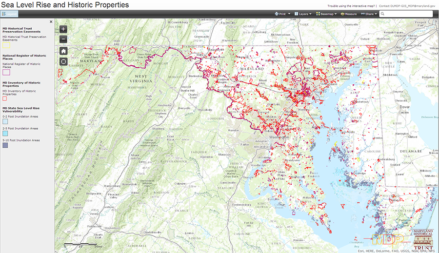 Click on image to view interactive map.
With funding from the Certified Local Governments program, the Maryland
Historical Trust is partnering with the City of Annapolis on a pilot project to apply FEMA's
guidance on hazard mitigation planning for cultural resources to help build resilience to
sea-level rise. The process includes documentation, a vulnerability assessment, and the prioritization
of intervention for historic and cultural resources as key steps. The process includes documentation,
a vulnerability assessment, and the prioritization of intervention for historic and cultural resources
as key steps.
